- Qinghai -
Qinghai is one of the important province on China's Qinghai-Tibet Plateau. The Chinese name "Qinghai" is after Qinghai Lake, the largest lake in China. Located in the northwest region in China, Qinghai borders on Gansu , Sichaun , Tibet and Xinjiang provinces. It is the source of Chinese two largest rivers Yangtze River and Yellow River; and it is also the birthplace of the Lancang River. It is known as the "source of rivers" and "Chinese water tower".Qinghai is world-renown because of the Qinghai-Tibet Railway, Qinghai-Tibet Road, the southern route of Silk Road, and the Tang-Tibet Ancient Road as well as the Marco Polo Line. They all go through here.

Basic Information
Chinese Name: 青海(Qing Hai)
Location: Qinghai borders Gansu on the northeast, Xinjiang on the northwest, Sichuan on the southeast and the Tibet Autonomous Region on the southwest.
Provincial Capital: Xining
Area: 720thousand square kilometers, Qinghai is the largest province in the People's Republic of China (excluding the autonomous regions).
Population: The total population of Qinghai is 5.78 million.
Average Altitude: 3,000 meters.
Major Ethnic Groups: Zhuang, Hui, Mongolian
Famous City: Xining, Delingha, Golmud.
Qinghai Geography
Qinghai is located on the northeastern part of the Tibetan Plateau. The Yellow River originates in the southern part of the province, while the Yangtze and Mekong have their sources in the southwestern part. Qinghai is separated by the Riyue Mountain into pastoral and agricultural zones in the west and east.
By area, Qinghai is the largest province in the People's Republic of China. Qinghai Lake is the largest salt water lake in China, and the second largest in the world. The Qaidam basin lies in the northwest part of the province. About a third of this resource rich basin is desert. The basin has an altitude between 3000 and 3500 meters.
The Sanjiangyuan National Nature Reserve, is located in Qinghai and contains the headwaters of the Yellow River, Yangtze River, and Mekong River. The reserve was established to protect the headwaters of these three rivers and consists of 18 subareas, each containing three zones which are managed with differing degrees of strictness.
Qinghai Climate
The average elevation of Qinghai is over 3,000 metres above sea level.Mountain ranges include the Tanggula Mountains and Kunlun Mountains, with the highest point being Bukadaban Feng at 6,860 metres. Qinghai forms a distinctive plateau continental climate because of the interactions of the factors, such as, its elevation, its terrain, its latitude, its geographic location, atmospheric circulation, etc. It is long but not cold in winter, short and cool in summer, and four seasons change obscurely. Its mean annual temperature is approximately −5 to 8 °C, with January temperatures ranging from −18 to −7 °C and July temperatures ranging from 15 to 21 °C . It is also prone to heavy winds as well as sandstorms from February to April. Significant rainfall occurs mainly in summer, while precipitation is very low in winter and spring, and is generally low enough to keep much of the province semi-arid or arid.
Tourism Resources
Located on the northeastern part of the Tibetan Plateau, Qinghai is a province in China surrounded by Gansu Province on the north and east, Xinjiang Province on the west, Tibet on the south and Sichuan on the southeast. It is named after Qinghai Lake, the largest saltwater lake in China.
Qinghai now has 11 world-class scenic spots, 79 national-level spots, as well as hundreds of provincial-level scenic spots. More than 400 tourism resources have developing prospects, and quite a lot of them can be describe as China’s, and even world’s, greatest attraction. The most representative landscapes such as Qinghai Lake, the Three River source Region, the Qilian Mountain grassland, the clear Yellow River, as well as the Kunlun Mountains Culture, the Kumbum Monastery, Liu Wan’s Colorfully Painted Pottery, and local ethnic custom parks allow one to appreciate the Tibetan, Mongolian ans Salar folk culture, etc.
Qinghai is relatively unknown to foreign travelers. This huge area is home to many Tibetan monasteries, vast grasslands, the headwaters of the three of Asia largest rivers - the Yellow River, the Yangtze River and Mekong River. It also boasts of a mosaic of ethnic groups, including Tibetan, Mongols, Tu, Goloks and Hui with a vibrant religious life.
For foreign travelers, Qinghai is one of the frontiers of adventure travel in China, a springboard for China' wildest travel for Lhasa by rail, Yushu by road, Gansu and Labrang Monastery by road, and further westward the ancient silk road to Xinjiang.
Qinghai Culture and Religion
Located mostly on the Tibetan Plateau, the province has long been a melting pot for a number of ethnic groups including the Han, Tibetans, Hui, Tu, Mongols and Salars. Tibetans constitute a fifth of the population of Qinghai and the Hui compose roughly a sixth of the population. There are over 37 recognized ethnic groups among Qinghai's population of 5.2 million, with national minorities making up a total of 45.5% of the population.The predominant religions in Qinghai are Chinese folk religions(including Taoist traditions and Confucianism) and Chinese Buddhism among the Han-Chinese. The large Tibetan population practices Tibetan schools of Buddhism or traditional Tibetan Bön religion, while the Hui-Chinese practice Islam. It is also a culturally intersection place where diversified cultures join together; including the Yangtze River, the Yellow River, the Indian civilization, the Islamic civilization, along with some ancient Greek culture and ancient Roman culture, which all originated here.
Qinghai Cuisine
Qinghai attracts tourists from all over the world, not only for its spectacular landscapes but also for its distinctive food culture. Each cuisine contains rich ethic specialties. People crave a gourmet month- watering snack.
Qinghai is one of the four major pastoral regions in China. Every herdsman here is a skillful cook. They specialize in cooking beef and mutton with a great look and taste. It is one of the traditional local delicious. Qinghai’s special drink, Tianpei-Sweet fermented barley, is made of highland barley with a sweet and refreshing taste which is quite similar to fermented glutinous rice wine. Gamianpian Noodles is a typical food for common Qinghai household. It can comes with or without soup. Stewing or boiling or stir-frieing, each cooking method turns out an unique taste.
There are also other kinds of delicious snakes like Fazi ( raft-shaped sausage), Naipi( a kind of cheese), Sanzi(fried noodle), Mashi(Pasta in soup), Assorted nuts and fruits, Niangpi (thin wheaten sheet), Steamed Beef Rendon, Braised Lamb Meat and so on.
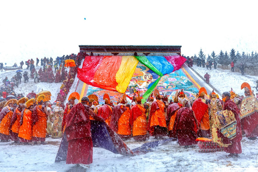
Folk Festivals
Nadam Fair
Nadam means “entertainment” or “games” in Mongolian language. Nadam Fair is a Mongolian annual traditional festival, especially popular in Inner Mongolia, Gansu, Qinghai and Xinjiang. It contains traditional but popular Mongolian sports, such as wresting, horse racing, archery contests, Bulu racing, lassoing horses and Mongolian chess. In some places, some competitive events such as track and field events, tug-of-war, volleyball and basketball matches are also held. During the grand fair, people enjoy performances of martial arts, polo, archery on horseback, swordsmanship on horseback, a horse-walking race, as well as a motorcycle race. In the horse-walking event, the participating horses are all well trained and their four hooves are not allowed to leave the ground at the same time during the race. Nadam Fair is held every year in July and August, when there are rich rainfall, lush grasslands, flourishing livestock, fine weather and fresh air.
Corban Festival
Corban means “sacrifice”, and is a major Islamic rite to show obedience and faith to Allah. Corban Festival, or Eid al Adha, is one of the major Islamic festivals celebrated by Muslims in Qinghai. It is also called the Loyalty and Filial Piety Festival among Chinese Muslims. Corban Festival falls on the 10th day of the 12th month in the Islamic calendar, and is the last day of pilgrimage activities. On that day, Muslims speaking Chinese, Turkish and other languages gather at mosques in splendid attire to celebrate the festival. After the ceremony, people in good financial condition will butcher a cow or sheep and split the meat into three parts: one for the poor, one for relatives and one for themselves.
Horse Racing Festival
Horse-racing is a major sport in Qinghai, and is very popular in Beishan (Ledu County), which is part of Xunhua, and pasturing areas across and province. There are two kinds of horse races: one judges the rider for his speed and footwork skill while the other judges the rider only for speed. To win the race, the rider must be good at selecting, raising and training his horse, last but not least, the horse-racing, which is the climax of the whole event. Some spectators will present colorful silk scarfs, called Hada or Khata, to the winner, and friends, relatives and female family members will hang embroidered bags on the horse’s mane. The winning horse is colorfully decorated with the largest number of embroidered bags.
Hua’er Festival
On the sixth day of the sixth lunar month, people across Qinghai celebrate this colorful event, and the one held in the scenic area of Laoye Mountain in Datong, 36 kilometers away from Xining, the capital of Qinghai Province, is the most famous. That day, people gather on the mountain to sing “Hua’er” songs (folk songs of love in Qinghai) in groups divided by ages. Singing “Hua’er” songs is a way for local people to express their love and the Hua’er Festival offers them an opportunity to find love, express love and sing love songs. Many good folk singers stand out in the singing contests.
Haibei Tibetan Prefecture
Located in the Northest of Qinghai Province, Haibei borders Gansu Province in the north, Haixi Tibbetan Autonomous Prefecture in the west, Hainan Tibbetan Autonomous Prefecture in the south, and Xining and Haibei District in the southeast.
Haibei was a place where ethnic groups such as Xirong, Territory, and Tuyuhun lived together in ancient times. With the change of the times, in addition to the Han nationality in Haibei, there are other Tibetan, Hui, Mongolian, Tu, Salar and other ethnic minorities living here.
Haibei Prefecture is located in the central Qilian Mountains, with an average elevation of 3654 meters, a maximum altitude of 5287 meters, and a minimum altitude of 2180 meters. From the perspective of landforms, there are valleys, basins, hills, low mountains, Zhongshan and high mountains.There are numerous mountains and lakes crisscrossing on this land. The most famous Mt Qilian and its branches stretching themselves on northeast to east range. The climate here belongs to the Continental Plateau Climate, with an average temperature of 0.3 ℃, when it is July and August, it is the hottest season with the most rains.
Haibei is a beautiful and a rich place with many ancient people here long long ago having left many national historical sites and unique culture on this land. Most important ones includes: Ganglonggou Caved Temple of Tang Dynasty, Ketu Ancient Town of Song Dynasty, the ancient triangle city of Song Dynasty. It is said that there once unearthed Sarcophagus tomb in 1989, with more than 700 objects found.
Haibei is abundant in its tourism resources with so mant historical sites and natural scenic spots. The most outstanding attractions includes Heihe Grand Canyon. As the second largest inland river in china and flowing through Qinghai, Gansu and Mongulia, Heihe is regarded as the Mother River of Hexi Corridor. one of the most beautiful grassland in China, Qilian Mountain Grassland.

Main Cities of Haibei
Qilian County
Nicknamed as the North Gate of Qinghai Province, Qilian County is located by the south of the Ancient Silk Road. As a key ecological tourism destination of the province, Qilian county boasts many attractions, like Qilian Pasture and Qilian Glacier and Forest Park. The former is one of the top six grasslands in China, and the latter is a national 4-star scenic area. It is well-known as Qilian Wonderland(or Fairyland), and represents the beauty of Qinghai Province.
The county is name after Qilian Mountain. Qilian was a word spoken by the ancient northern nomads, which means heavenly mountain in English. The mountain lies in the north of Qinghai Province. It is the home A variety of religions and traditional cultures have integrated in the land for centuries. It is an ideal place for visitors to appreciate the minorities’ authentic folk customs and traditions. The relic of the Tang-Tibet Ancient Path is one of the most impressive cultural attractions in Qinghai Province.Nowadays, Qilian attracts more and more tourists with its unique culture and gorgeous landscape.

Menyuan Hui Autonomous County
Menyuan Hui Autonomous County is a county in the northeast of Qinghai Province, China, bordering Gansu province to the north. It is under the administration of Haibei Tibetan Autonomous Prefecture. Menyuan is situated on the Datong River between the Qilian Mountains and Daban Mountains. Gangshiqia Peak rises dramatically in the north of the county.
Members of more than five minorities live in this area, such as Hui, Tibetan, Tu, Mongolia and Sara. Menyuan is the production base of cole in the northern China and production base of oil plants in Qinghai Province.
Baili Rape Flowers – Rape Flower Tourist Festival is held in Menyuan in July every year. The golden rape flowers are in full bloom from the Qingshizui to the Xianmi gorges, about 50 kilometers long and 12 kilometers wide. The rape land in Qingshizui is flat and open, running southward directly to the foot of Qilian Mountain. Except for a few houses and the snow-capped Qilian Mountain, thousands of hectares of rape land reveal the same color, like a great piece of nugget. The golden world of Menyuan County is famous for its vast green fields and yellow rapeseed flowers.

- $1198.00
- 9D8N DAYS
01. Monlam Festival (or The Great Prayer Festival) is the grandest religious festival in Tibet, the 10-Day Amdo Tibetan Monlam Festival tour offers you an opportunity to attend festival events with thousands of local Tibetan nomads, you can …
Read More
- $948.00
- 7D6N DAYS
1. Kanbula National Park: Gazing out across some of the most sublime mountain and river panoramas in the land, Stunning landscapes of Danxia Red Peaks and forest, lakes, Tibetan pastures, valley and monasteries on the peaks.2. Qinghai Lake :…
Read More