Wusu Travel Guide

Wusu is a county level city under Tacheng Prefecture of Xinjiang Uygur Autonomous Region, China. It is located in the northwest of Xinjiang Uygur Autonomous Region. It borders Karamay City, Kuitun City and Shawan City to the east, Nilek County to the south, Jinghe County to the west and Toli County to the north. The total area of the city is 20,700 square kilometers. There are Kazakh, Han, Uygur, Hui, Mongolian and other ethnic groups. The population is 214,600.
Wusu is located in the north slope of Tianshan Mountains, the southwest margin of Junggar Basin, Eurasian land bridge, national highway 312 and Duku highway junction.
● What to do & where to go in Wusu
Wusu Jiulian Spring Water View Park was listed as a 3A(third level) scenic spot in Xinjiang Uygur Autonomous Region.
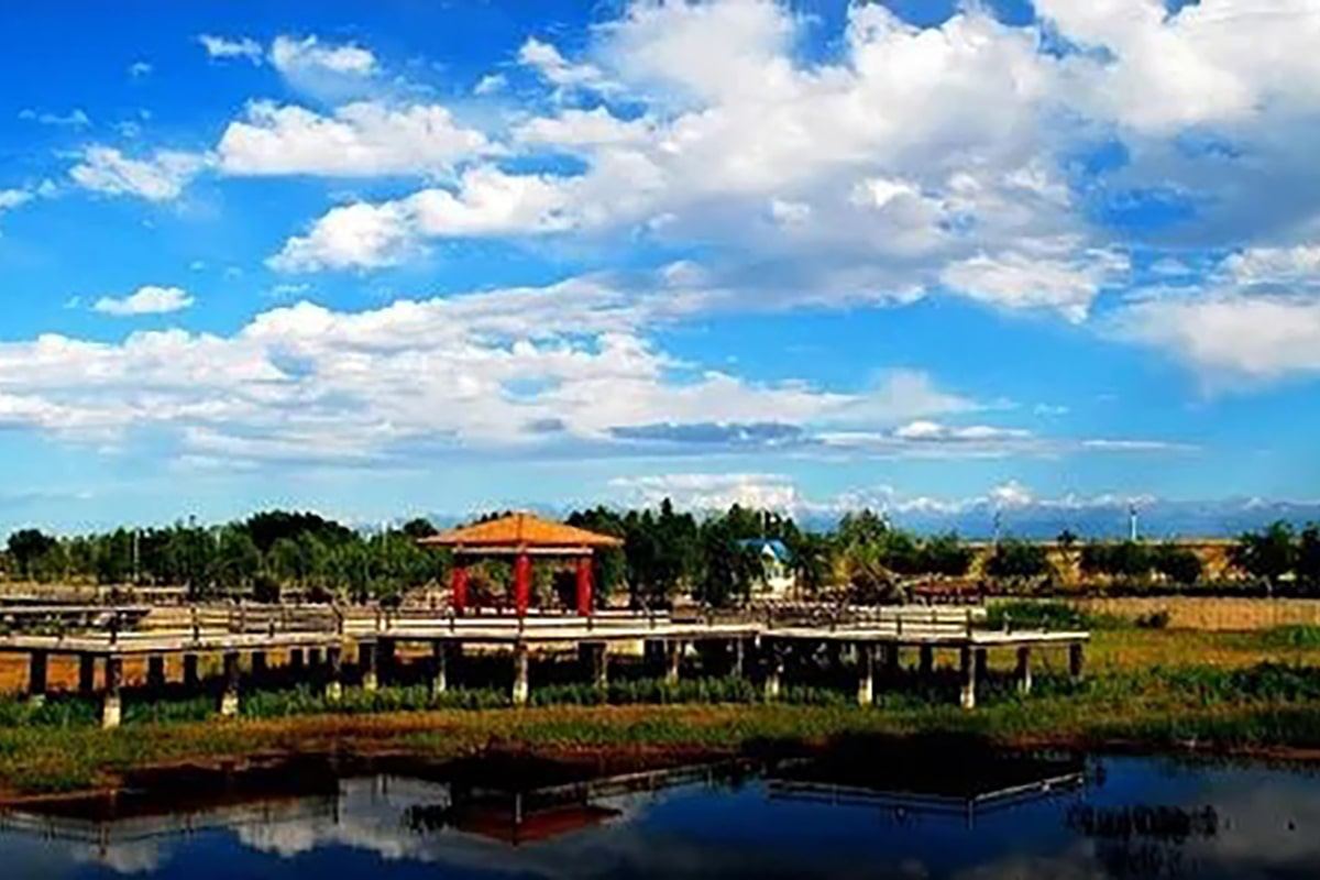
The Gultu Swan Lake Scenic Area is home to many species of birds. Wetlands are rich in aquatic plants and home to many species of birds. In spring and autumn, thousands of water birds, mainly whooper swans and wild ducks, gather here and make it become a world of birds.
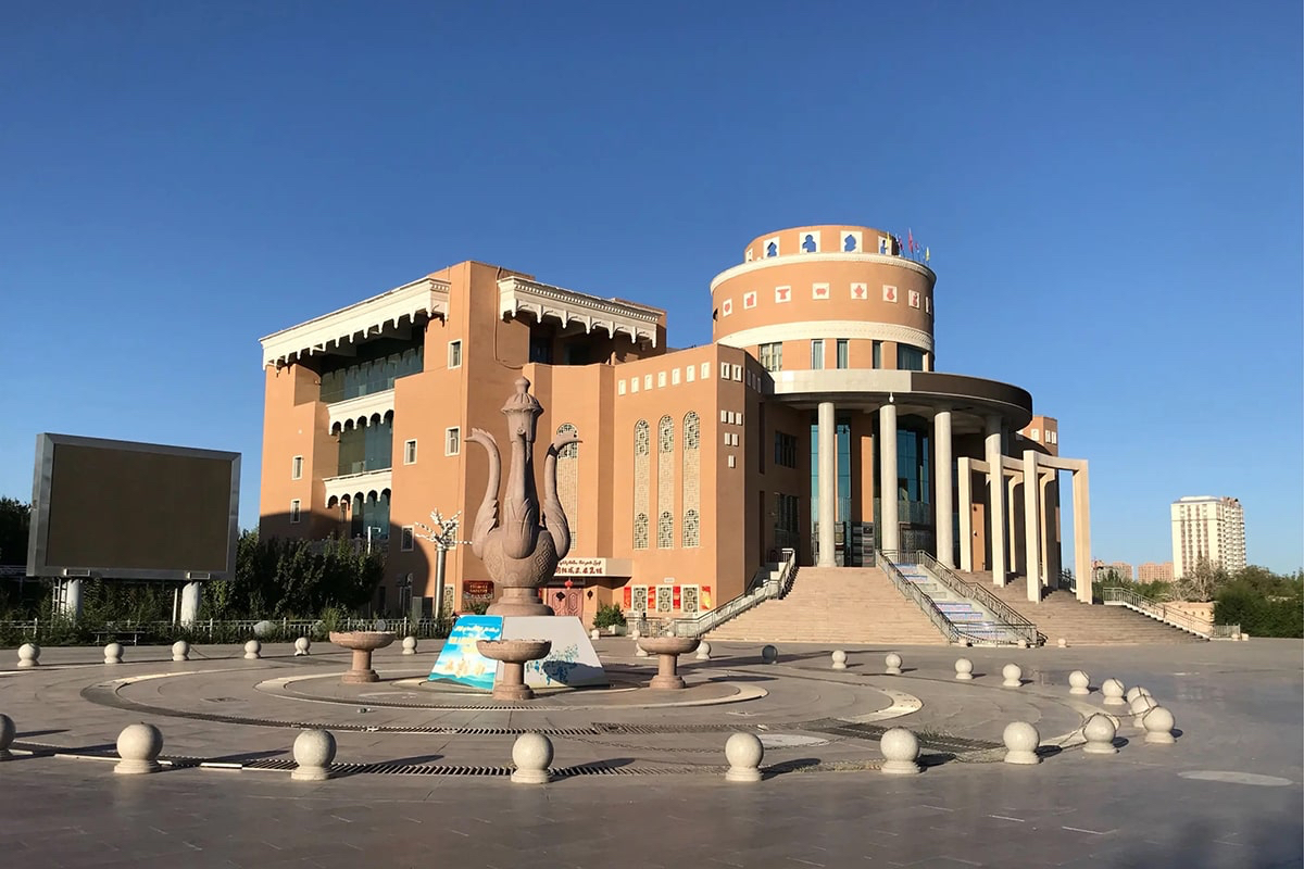
The Chinese Mosque is the earliest Hui mosque built in Wusu County with a history of 227 years. Adopting the characteristics of Arab Islam, it can accommodate 300 people for worship.
Bayin Valley Chenghua Lama Temple in Qing Dynasty.
Ganjia Lake Saxoul Forest Nature Reserve is 320 meters above sea level, located in the Gultu Ranch of Usu City, 65 km to the southeast of Usu City as a straight line. It is a drought-tolerant jungle on the alluvial depression on the northern slope of Tianshan Mountain where ammodendron, tamarisk and populus euphratica grow together and are very lush.
● What to eat in Wusu
Gurtu roast whole goat, chicken with pickled cabbage and chili, tarragon fish, Majik braised pork in brown sauce, pancakes fish.
● Transportation
Railway: Wusu Station is 2,200 kilometers away from Lanzhou Station on the Lanzhou-Xinjiang Railway, 237 kilometers away from Urumqi West Station and 219 kilometers away from Alashankou Station on the downlink.
Highway: Wusu City is the key place for Yli, Bortala Mongolian Autonomous Prefecture, Tacheng, Altay and Karamay. The national highway 30 and 217, Duku Highway and the Second Eurasian Land Bridge (Railway) run across the east and west, north and south of the Tianshan Mountains. The Kuibei Railway and the Kui-Sai High Grade Highway run through the territory which is 260 kilometers away from Urumqi, the capital city of Xinjiang Uygur Autonomous Region. The 10-minute economic circle encircles Dushanzi District, Kuitun City and the 7th Division of the Corps, which is in the core position of the Kui-Du-Uzbekistan "Golden Triangle" region. 2 hours economic circle encircles Jinghe County, Karamay City, Shihezi City, Shawan City and Manas County. 4 hours of economic circle encircles Urumqi, Changji, Tacheng, Bole and Yining City. It covers the land treaty ports of Khorgos, Alashankou, Bhaktu, Jimunai and Dulata in an area of about 400 kilometers.
Airport: It is about 245 kilometers from Urumqi Airport and 361 kilometers from Tacheng Airport.
● Climate
Wusu is located in the north temperate arid region, a typical continental climate. Its characteristics are: winter and summer are long, spring and autumn are short, the four seasons are distinct, the temperature difference within the year is large, the light is sufficient. Rainfall is scarce, evaporation is intense and relative humidity is low. There are hot dry winds in summer and cold currents often invade in winter. Because of the north - south topographic elevation difference of more than 4,000 meters, thus the climate inside the formation of distinct vertical distribution of different microclimate zone. From south to north, the climate can be divided into four climatic zones: mountain climate, foothill climate, plain climate and desert climate. The possible sunshine duration is 4,444 hours and the actual sunshine duration is 2,600-2,800 hours. The extreme minimum temperature was -37.5℃, the extreme maximum temperature was 42.2℃. Precipitation is mainly controlled by cold and humid air currents over the Atlantic and Arctic oceans. When the cold and humid air flows from the west or northwest over the western boundary mountains of Junggar, the Jinghe area and the Chepazi-Karamay line form a desert area with less rainfall. The plain area is windy in spring and summer and the summer is high temperature and dry. The average annual evaporation of the naked land is more than 2,000 mm.
- HOTEST
- RECOMMEND