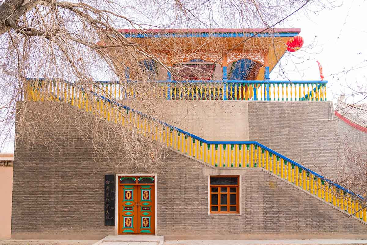
Karamay Urho Devil City
Chinese name: 乌尔禾魔鬼城(Wu Er He Mo Gui Cheng)
Location: No.200 Longji Road,Wuerhe District, Karamay, Xinjiang.
Ticket: Entrance ticket CNY46.00,Sightseeing bus CNY52.00
Estimated tour time:3-4 hours
Recommended time to visit: May to Oct
Nearby attractions: Kanas Lake, Hemu Village, Rainbow Beach,Anjihai Grand Canyon, etc.

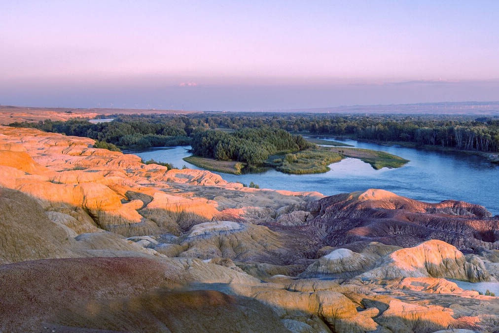
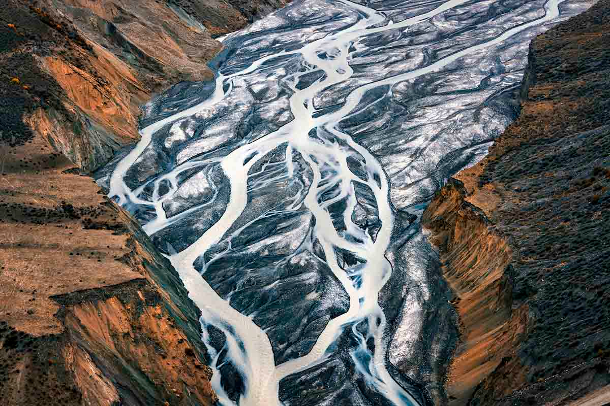
Karamay World Devil City, located in the hinterland of Eurasia, Junggar Pendi Northwest Edge, Karamay Wuerhe territory, distance from your wo city 11 kilometers, 100 kilometers away from the area of Karamay, the core scenic area of about 22 square kilometers. Here has the world-class Yadan landform, the magnificent oil production picture, the vast desert scenery, precious gold silk jade, is the leisure sightseeing, the hiking expedition, the photographic film and television, the popular Science examination and so on the resort.
World Demon City Genesis: Karamay World Demon City is a world-class Yadan geological landform scenic spot, to fully understand the world Demon City, we must first understand what is Yadan landform. According to the study, in the Lower Cretaceous period 130 million years ago, this was once a huge freshwater lake, and several times the crustal movement formed the Gobi platform today. After millions of years of wind and rain erosion, the formation of different shades.
● Urho Devil City
Urho Devil City is located over 100 kilometers northeast of the urban area of Karamay. It covers a circular area with a radius of over 30 kilometers, bordering Hala’alat Mountain in the north. the total area of 128 square kilometers, belonging to the typical Yadan landform, it was observed that, about more than 100 million years ago, the Cretaceous period was a huge freshwater lake, and then after two large crustal movements, the land rose, the lake dried up, the lake became a terrestrial vast, geologically called the Gobi platform.
Geologically speaking, Urho Devil City is an area of wind-erosion landform or yardang landform. The landform consists of various sedimentary rocks that formed in the Triassic Period, various Jurassic turbidite and various sedimentary rocks that formed in the Cretaceous Period. It is a typical wind erosion and water-washed landscape. Various significant natural landscapes have formed after a considerable period of time has passed by.
Being one of the few typical wind erosion physiognomies in the world, the Ghost City has become a famous tourist area for its unique landform and the howling wind.
After erosion by wind and water for eons,many of the hills have been turned into various “buildings” by the wind there. the raised stratum of the Ghost City has been carved into great mounds with various shapes, some mounds look like castles, temples, pavilions and beacons of the city wall, while some resemble lions, horses, and eagles. There is a viewing deck inside, where can overlook the Devil citys full picture, here can feel the Devil City of Desolation, original and grand, brilliant.

● origin of the Name "Ghost Town"
Urho Devil City It is not the city, nor the devil, but for millions of years to shape the wind. Because it is located in the Tuyere, Devil City Four Seasons Wind constantly, one years windy weather can reach 300.In ancient times, there was no road linking the area to the outside world and there were no habitations in the surrounding area. When great winds or sand storms rose, they roared through the town like howling ghosts with sand and dust blocking out the sky. It is so dreadful that this area become known as the Ghost Town.
● Formation the World Ghost Town
Karamay city is the world devil Yadan physiognomy scenic world class, to fully understand the world of the city, we must first understand what is yadandemao. According to the survey, in the Mesozoic lower Cretaceous since 130 million years ago, it was once a huge freshwater lake. After several crustal movements, it formed todays Gobi platform. In the millions of years of wind and rain erosion, the formation of all shades of gully, bare gravel and soft sandstone, become, carved in the wind rain in different poses and with different expressions of odd shape cut, evolved into a unique landscape of the majestic, the world of the city scenic spot in the yadandemao in Chinas earliest geological formation.
- HOTEST
- RECOMMEND